
For anyone using the AlpineQuest app on their phone as a mapping/navigational aid...
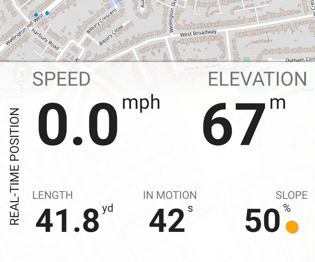
I'd suggested adding the slope-angle as one of the available fields on the explorer-mode display (Initially to give the gradient whilst cycling - similar to Garmin etc cycle computers)
However I realised it could also be valuable to check if a slope is greater than 58% (ie >30⁰) for avalanche risk assessment (maybe by laying a pole down the slope and measuring that)
In the latest release of AQ, François has implemented a Red warning symbol 🔴 on slopes greater than 30⁰ (58%), which is preceded by an Orange 🍊 warning as you approach this angle.

DominicByrne
Hi Geoff. I'm new to Alpine Quest, having just paid for the fully featured version and intending to use it for ski touring. I thought it had a shaded slope angle facility (i.e. different shades for different gradients of slopes) but perhaps I am wrong as I can't find that feature. I've only just started playing around with its features a few minutes ago. I note the extensive choice of maps. What map views do you tend to use? I am currently looking at the Chamonix area in open topo and base map mode but I see there are some specific French maps that can be loaded. Have you used it much for ski touring? I'd value any general tips and guidance.
Steve Lenartowicz
Hi Dominic
I am also new to AQ Pro. I have not seen a shaded slope angle facility, but there is a facility to measure slope angle between two points using the Tools function on the centre marker.
I have been looking at the available maps - in the menu of France IGN maps there is a Plan IGN but at large scale it does not have the full topographical features of a TOP 25 paper map. Do you know if it is possible to get a full topo map?
cdpej
I dont use alpine quest but if it doesn't give shaded slope angles (30, 35, 40,) it isn't really suitable as a ski touring app. Many of the French ski touring routes have recently been redrawn so you will want to have these as well. Skitourenguru is a good place to get these. I use iphigenie for IGN maps on my phone.
PaulCooper
You can add slopes as layers. Set opacity, to whatever you find looks good. AQ is great, you get all UK OS at 1:50,000 for free. Good alternative, with similar functionality is Backcoutry Navigator
GeoffGaunt
Hi All - the shaded slope angle is in one of the DEM (digital enhanced mapping) overlay layers - I add 2 of the layers "DEM hillshade layers" and "DEM Slopes (+30deg) Layer" to all my workspaces and as Paul said adjust the layer opacity.
Worth setting up multiple Workspaces for each country you're loading maps for, so you have them all to hand (rather than re-loading different maps into the default workspace each time you change country)
You can have multiple maps in a workspace - just make sure you load just one as your base map, and any additional maps select "add as layer", then you can switch between different map layers turning them on/off with the eye symbol - if you add a new map as a "map" rather than a "layer" that re-initialises the workspace :-(
Free OS (1:50 - 1:25 etc as you zoom) available by adding www.bing.com/#os in the add new maps>suggest selection - slightly out of date maps (new roads/estates etc) but the hills don't change
GeoffGaunt
Steve - I have all the (free) IGN mapping sourced from the www.geoportail.gouv.fr/carte website.
That gave me Carte Topo; Carte Scan Express; Images Aeriennes; Carte Raster; Carte du littoral plus several more
Unfortunately that link doesn't load the same datasets into AQ any more - However I have a simple fix to pick up the required datasets which I can share with anyone if required
Steve Lenartowicz
Thanks Geoff. I have switched to OutdoorActive for the time being.
GeoffGaunt
Steve - fine: I know everyone gets very possessive about their favourite apps, but I've found AQ to be the best in use over several years.
For instance this image shows the (free) IGN Carte Topo map with the DEM slopes >30⁰ overlay, plus our planned route drawn in yellow and the actual recorded route in light blue